Geospatial Services
Eastdawn's geospatial service offering includes a wide range of photogrammetry and Lidar data processing disciplines. All data products created are in customer defined output formats or can be provided in a spatial geo-database. Geo-database options include structuring and attribute creation. Eastdawn can meet ASPRS and USGS specification standards.
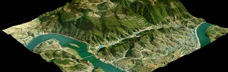
Photogrammetry
Eastdawn offers our clients a wealth of photogrammetry services including, aerial triangulation, digital elevation and terrain modeling (DEM, DTM), orthophoto creation including color balancing and mosaicking. In addition, the company offers a wide range of feature collection services. These services can be provided using data from aerial photo and satellite platforms.
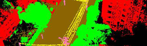
Lidar Processing
Lidar services offered by Eastdawn include calibration, the creation of intensity images, classifications such as DTM, buildings and other standard products. Sources of Lidar include airborne, static and vehicle-borne systems.